Rural fencing in the Pioneer Valley
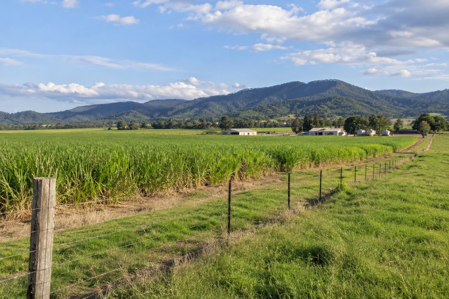
If you are looking for fencing in Walkerston, Marian, Eton or Mirani, you are in Mackay Regional Council country along the Pioneer River. Cane country is part of the picture here, and the census shows high shares of separate houses as well. Your enquiry is passed to a local contractor, who quotes and does the work. We refer; we do not build fences. For the region as a whole see the home page.
What the 2021 Census shows in the valley
The ABS publishes each place under several labels. The table uses the locality for each town and the Walkerston-Eton statistical area (SA2) for the wider district. Separate houses are the share of occupied private dwellings, and the ABS applies small random adjustments to its counts.
| Area | People | Separate houses | Largest industries (share of jobs) |
|---|---|---|---|
| Walkerston-Eton (SA2) | 8,457 (median age 38, 3,334 private dwellings) | 87.8 per cent | Coal mining 10.3 per cent (442 people), sugar cane growing 5.3 (229), hospitals 3.3, sugar manufacturing 2.9, road freight 2.8 |
| Walkerston (locality) | 3,615 (median age 35, 1,407 dwellings) | 92.2 per cent | Coal mining 12.2 per cent, sugar manufacturing 3.1 |
| Marian (locality) | 4,224 (median age 32, 1,465 dwellings) | 98.9 per cent | Coal mining 13.2 per cent, sugar manufacturing 2.6 |
| Eton (locality) | 728 (median age 37, 281 dwellings) | 93.4 per cent | Coal mining 14.2 per cent (46 people), road freight 5.3 |
| Mirani (locality) | 1,806 (median age 33, 649 dwellings) | 93.7 per cent | Coal mining 11.8 per cent (84 people), sugar cane growing 3.4 (24) |
Marian has the highest share of separate houses of any locality on this site, 98.9 per cent, and a median weekly household income of $2,392 at the 2021 Census. Counted as urban centres, the ABS gives Walkerston 3,567 people, Marian 3,615 and Mirani 1,554. The Mirani electoral division is a different thing: 50,190 people across a large area, not a town, with coal mining at 9.8 per cent of jobs (2,254 people), sugar cane growing 2.8 (644) and beef cattle farming 2.7 (633).
Cane growing is a real employer in the Walkerston-Eton district, but coal mining is larger in every row above. Housing counts cannot tell you lot sizes, so any lifestyle-block reading is an inference. The horse and lifestyle block page covers that side.
The valley and the river
A secondary source puts Walkerston about 14 km south-west of Mackay (Wikipedia) and Mirani about 37 km west (Wikipedia). We give no distance for Marian, because the source we found states two figures. The same kind of source calls the Pioneer River catchment one of Australia's richest sugar cane areas. Treat that as a general description, not a measure. The cane side of fencing is on the cane boundary page.
What the Pioneer River flood record says
The Bureau of Meteorology's Pioneer River flood brochure puts the catchment at about 1,500 square kilometres and says flash flooding "occurs frequently along Cattle Creek at Finch Hatton". In extreme flows, floodwater can break out between Mirani and Marian into Sandy Creek. Peak travel time from Mirani to Mackay is generally 3 to 6 hours. Flooding is documented back to 1884, and the brochure does not state a flood season.
The readings are large. Mackay's highest peak was 9.14 m at Forgan Bridge in February 1958, and Mirani's highest record is 16.46 m in the same month, from a manual observation. The 2017 peak at Mackay was 7.4 m, and the minor flood level, then 7 m, has since been revised to 6.3 m. The 2024 peak at Mackay was 7.12 m. In January 2026, during Tropical Cyclone Koji, peaks were 7.28 m at Finch Hatton, 11.56 m at Mirani and 6.15 m at Mackay. The brochure says nothing about fences, so these figures show how the river behaves, not what a fence should be. For design points and recovery, see the storm and flood repair page.
Cyclone Debbie, Sandy Creek and Bakers Creek
The Bureau's Cyclone Debbie summary (Tropical Cyclone Debbie) says nearly 100 people needed help in the Eton and Homebush areas. The council's flood overlay code page (council page) names Eton, Drapers Siding, Homebush and Chelona in its Sandy Creek Catchment Flood Study, adopted on 12 February 2020. The page is out of date against the current scheme and does not mention fences. For Walkerston, the council's floodplain plan says Bakers Creek flood levels are mostly higher in the Walkerston area in the flood studies that followed Debbie and supersede a 2013 study. Whether those maps touch your fence line is a question for the council.
Council, neighbours and the Act in the valley
Mackay Regional Council covers all four places. Its number is 1300 622 529, and it has a customer service centre at 20 Victoria Street, Mirani, open Monday to Friday, 9am to 4pm (council dividing fences page). The council describes no role in fence disputes and names a "Notice for contribution to fencing work" form. For the Act itself, read the dividing fence law page. In short, s 8(3) takes a boundary between two parcels of agricultural land outside the chapter, and cane beside grazing land, a lifestyle block or a road is not interpreted here. Ask QCAT, the council or a solicitor.
The creeks, roads and vegetation page covers clearing limits, and the Mackay city fringe page covers the other side of the river country.
What to send when you ask for a quote
Send the town, a photo of the fence line, its rough length, who the neighbour is, how close the line runs to the river or a creek, and whether the ground is flood-prone. In this valley, add how you reach the line in the wet. Ask each contractor which licence or registration they hold, check the QBCC register (139 333) and read the licence page for what the pages say and where they stop. Then send your details.
What this page cannot tell you
It cannot tell you whether your fence sits on a mapped flood area, which cyclone or flood will come next, or how the Act's contribution rules apply between cane and a lifestyle block. We found no climate source for Walkerston, Mirani or Eton, no soils source for the valley and no figure for how often the river damages fences. We give no distance for Marian. Ask the council about the maps, ask QCAT or a solicitor about the Act, and ask the contractor how they would build for a river that rises quickly.
Check the current rules before you rely on this
This page describes rural fencing in Walkerston, Marian, Eton and Mirani, with the census, council and Pioneer River flood facts we could verify. It describes the rules in general terms as they stood in November 2026. Standards, forms, thresholds and fines change.
The authoritative sources are Mackay Regional Council, contact us, Bureau of Meteorology, Pioneer River flood brochure, Mackay Regional Council, Mackay floodplain risk management study and plan (adopted 24 November 2021), ABS 2021 Census QuickStats: Marian (locality) and Bureau of Meteorology, Tropical Cyclone Debbie, March 2017. Where anything here differs from those sources, they are right and we are not.
We are not fencing contractors, builders, regulators or lawyers. For what applies to your fence, ask the contractor which licence or registration they hold and check it on the QBCC register (139 333), then ask the council that covers the land: Mackay Regional Council (1300 622 529), Whitsunday Regional Council (1300 972 753) or Isaac Regional Council (contact details on its website).
Accurate at the time of writing, November 2026. Always check the source before relying on it.